
Working with a Trimble receiver in Mergin Maps used to mean using a third-party mock app to access the receiver’s data. On Android, that included digging into developer options and picking a mock location app before you could start your surveying work. On iOS, the position came through with barely any of the information you actually need in the field, no accuracy value, no satellite details, and the system could decide to ignore the mock provider at any point. It worked, but it asked a lot of you before you even got to the map.
That changes with our latest release. Mergin Maps now talks directly to the Trimble Mobile Manager (TMM) app, which means Trimble devices get their own connection option in the app. If your receiver is already set up in TMM, connecting it in Mergin Maps takes a single tap, and the full stream of GPS data comes with it: accuracy, HDOP, satellite information, the coordinate reference system reported by the receiver, and more.
How it works
The Mergin Maps mobile app communicates directly with the Trimble Mobile Manager app, which handles the connection to your Trimble device. Everything on our side is deliberately minimal. You pick Trimble from the list of providers, the app establishes the connection in the background, and from that point on your project uses the position reported by the receiver instead of your phone’s internal GPS. We also read the antenna height from TMM, so the value you set once in Trimble’s app is the value used for your measurements.
Here is what the setup looks like from start to finish:
Step 0: Make sure the Trimble Mobile Manager app is installed on your phone and that your receiver is connected to it. Trimble’s own documentation walks you through that part.
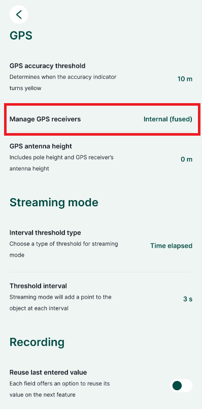
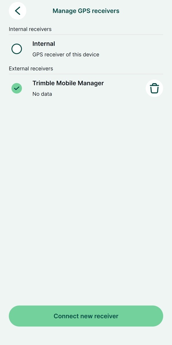
Step 1: In the project settings, go to GPS and tap on Manage GPS receivers. At the bottom of the screen, tap the “Connect new receiver” button.
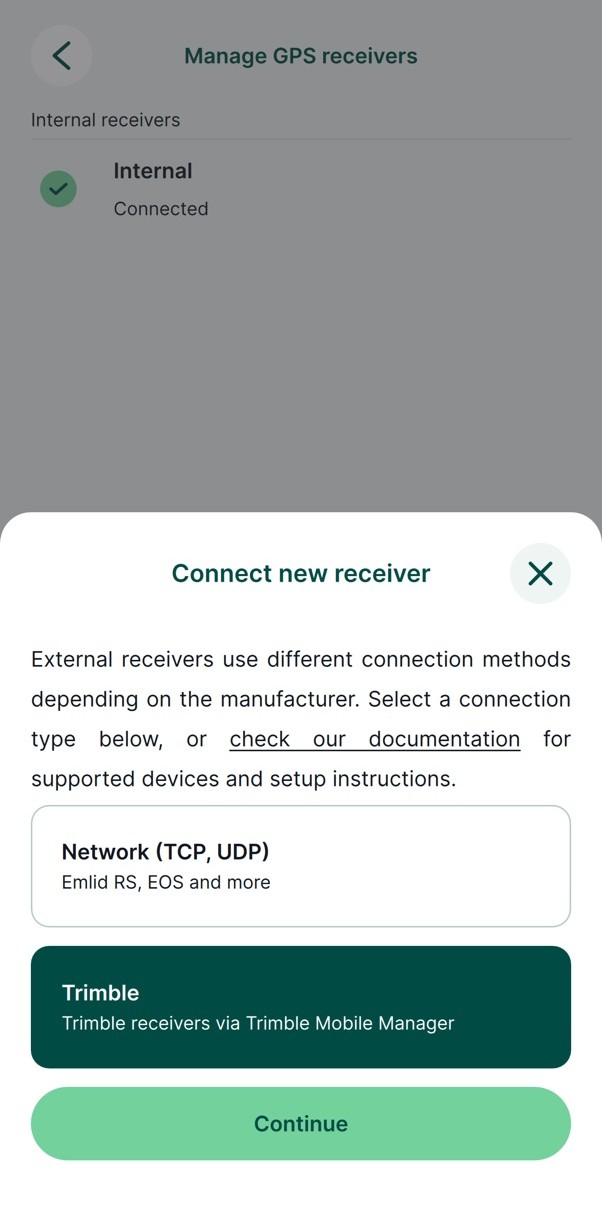
Step 2: When you are asked to choose a provider, tap the Trimble option.
Step 3: The app takes care of the rest. It communicates with TMM automatically and establishes the connection, after which the GPS data coming from the antenna is available throughout Mergin Maps.
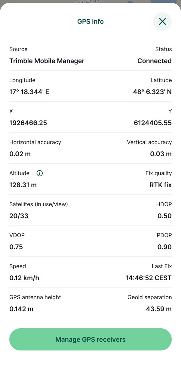
Worth checking: if you have not set the antenna height in TMM, open the project settings in Mergin Maps and tap the antenna height entry. You will be redirected straight to the corresponding field in the TMM app, and once it is filled in, the correct antenna height shows up in Mergin Maps.
Ready to get started?
To start surveying with a direct Trimble connection, you need a Trimble receiver, the Trimble Mobile Manager app installed and up to date, and version 2026.4.0 of the Mergin Maps mobile app.
A big thank you to Trimble for providing the hardware that helped us develop and test this functionality!