Efficiently collect geolocation data with Mergin Maps and QGIS to be compliant with the EUDR.
Generate geolocation files in standardized formats such as GeoJSON, required for EUDR documentation.
Capture geolocation data seamlessly in remote coffee plantations, cocoa farms, and timber areas with limited or no internet connectivity. Sync data once you are back online.
Capture location with each entry, improve accuracy and enable precise mapping of production plots, boundaries, and harvest areas for EUDR compliance.
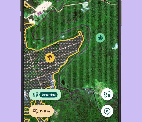
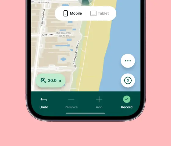
Record your path while using the app, allowing you to visualise your survey route and ensure complete plot coverage.
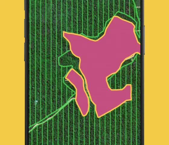
Visualise collected data directly on a topographical map with the same cartographical styles as QGIS, including polygon boundaries and satellite imagery.
Allow field teams to use digital forms on mobile devices with advanced data validation rules for capturing producer details and plot information.
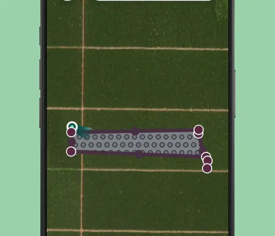
GPS integration ensures precise location capture for each tree, streamlining record-keeping or timber volume calculations. You can connect external GNSS devices for more accurate location data.
It is easy to customise map layers in QGIS to improve task management with your team depending on the nature of the project (e.g. for coffee, cocoa beans, cotton, etc). You can add custom layers such as road network maps, satellite imagery, and remote sensing data or create rules to update symbols to reflect job status.
No technical skills needed—just hand over a mobile device and let your team start mapping. Our solution is built for field use, with a clean, intuitive interface that’s easy for farmers and non-technical staff to navigate.
Coordinate work across teams by assigning user roles - admin, collaborator or reader (for free). Update the progress of jobs in the field with forms, images, and symbology. Use position tracking to keep track of teammates and assets.


.webp)
