
We get a lot of questions about how our users can customise their projects in Mergin Maps. One topic that comes up often is about how to create custom names for photos associated with features. By default, photo names are assigned using the naming convention from the camera app. The photo names from the camera app are usually using timestamps, e.g. 20230829_120146.jpg . This can be inconvenient when photos are moved around or when you want to browse photos of your assets outside QGIS. With the introduction of this new feature, you can name the photo based on an expression and values from your attribute table, therefore, you will have more descriptive names for your photos. We’ve put together a tutorial on how to do this.
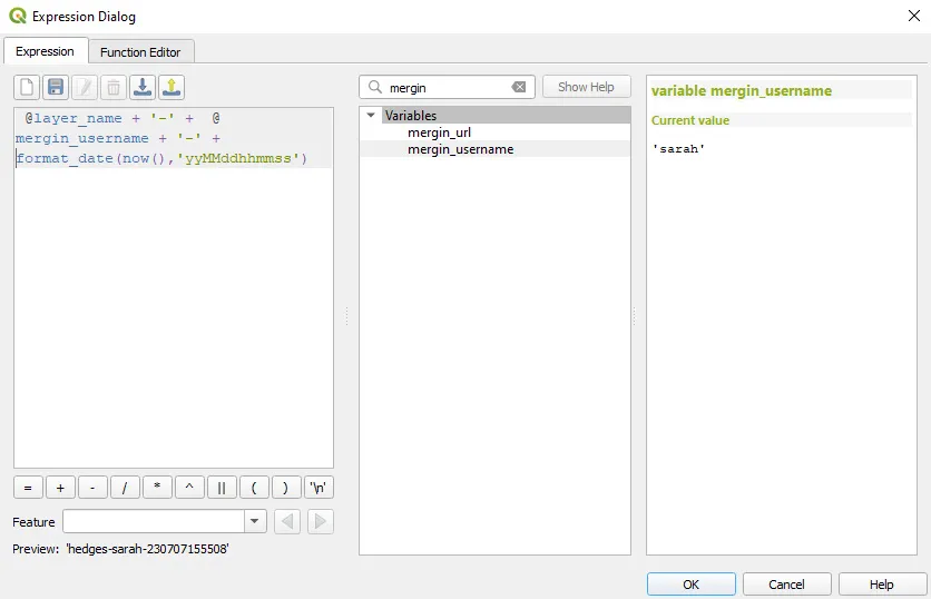
The process is fairly simple. Just open your project in QGIS and navigate to the Project properties menu. From there, you can go to the Mergin Maps properties tab and open the Expression builder. Select the photo layer you wish to edit and then use the dialog to build the expression you want to use by selecting layers and attributes you want to use for the file name for each photo. You can select fields from survey forms, usernames, timestamps and other expressions to generate unique filenames for your photos.
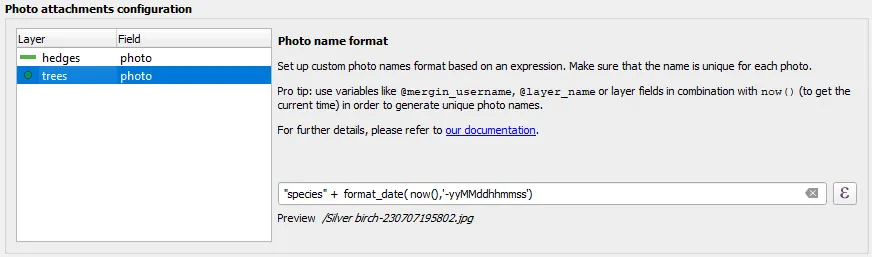
There are some general rules you’ll want to follow as a best practice such as:
- Each file name needs to be unique
- The extension ‘.jpg’ is added automatically
- Make sure that the fields being used to generate names are filled in on the survey form. You can use the form builder to require your users to fill in the field before submitting the file to the project.
- All fields must be converted to string format in the expression
Once you save the setting, make sure to synchronise the changes to your project so that new photos will be named according to the new settings. Photos previously saved to the project will not be renamed.
Check out the full tutorial in our documentation to see the correct steps for this process as well as screenshots of examples that you can follow.
Note when you set the naming expression, it is a good practice to have unique names.
Also, if your project has a lot of photos, you might be interested in this video showing you how to synchronise photos from Mergin Maps to other file storage options like Amazon S3 or MinIO using Media Sync. Syncing photos externally and linking them back to your Mergin Maps project can improve project loading times on mobile devices, meaning that your teammates can work more efficiently and use less data.