
Recording lines and polygons with your mobile device in Mergin Maps is simple. There are a couple of methods to do it and we would like to help you decide which is the best way for your situation.
The two methods for recording a line or polygon in the app are to either manually enter each point in the line or area, or to use the streaming mode to automatically collect each point until you’ve traced the area you wish to record.
Manual recording
The first method for recording a line or polygon in the app that we’ll discuss is the manual recording method. We’ll assume that you already have a layer in your project for recording lines or polygons.
1. To start recording a line, click the “Add” button on the main screen. Make sure that you have the correct layer selected at the top of the screen and that the centred on GPS icon at the bottom right of the map screen is highlighted in green as seen below. If the indicator is not green, press the button and the app will centre on your position:
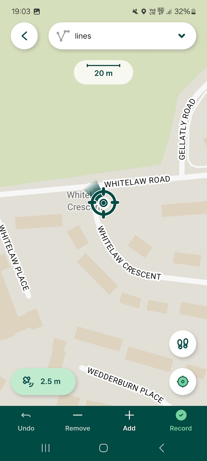
2. Click the “Add” button to record the first point in your line or shape.
3. Walk to the next point where you wish to record another point, make sure the GPS is centred on your location and click the “Add” button again:
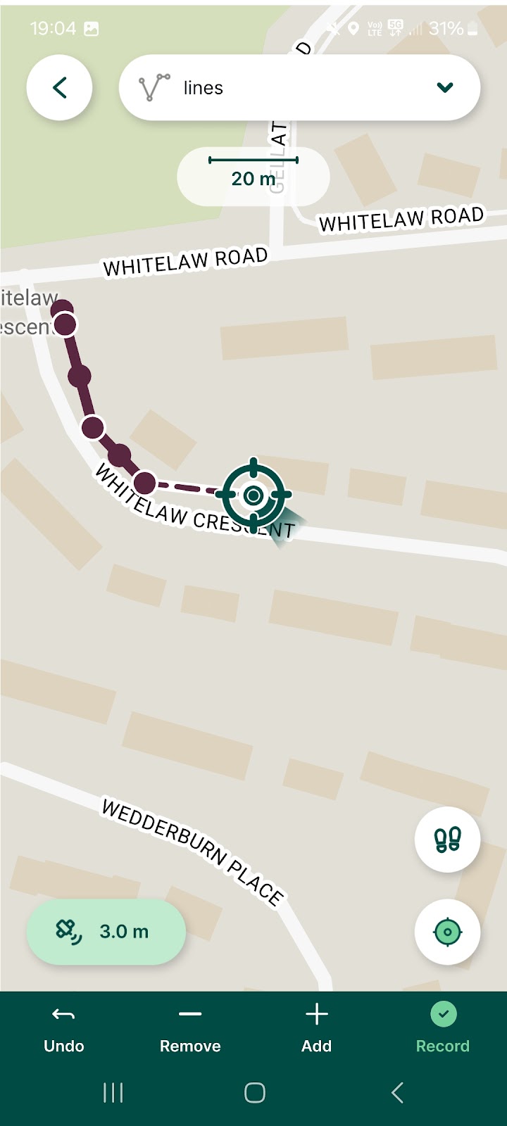
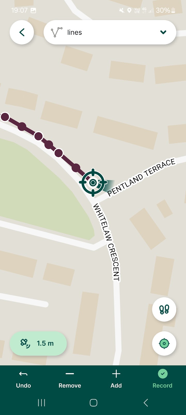
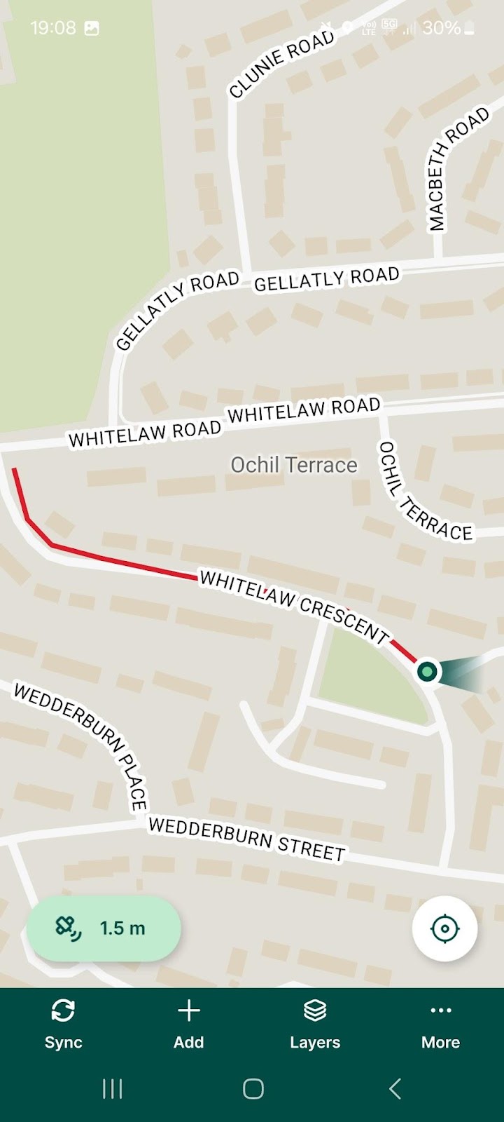
4. Continue walking and adding points to your line or shape until you have recorded everything you want for this feature. In between adding points, you can put the app in the background or turn off your device screen to save battery. Just be sure that you do not close the app. Once you have all the points you want for this feature, click the “Record” button to finish recording the feature. If you are recording a polygon, the app will close the shape when you hit “Record”:
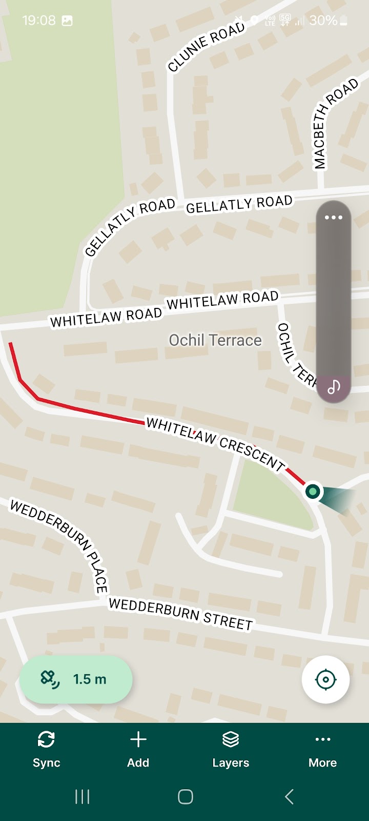
5. The app will then return to the form for your line or polygon layer so you can enter any additional information. Once you have finished, make sure to click the green check at the top right to save your feature:
Streaming Mode
The other way to record lines and polygons is to use the streaming mode. This method will record the points automatically.
1. If you go to More>Settings>Streaming Mode, you can choose to have the app record points based on time or distance intervals and control the threshold for each.
2. Once you have set the app up to record based on the intervals you prefer, go to record a new line or polygon just as you would for manual recording. Make sure the app is centred on the GPS location as before and then click the button with the two footprints to begin recording in streaming mode:

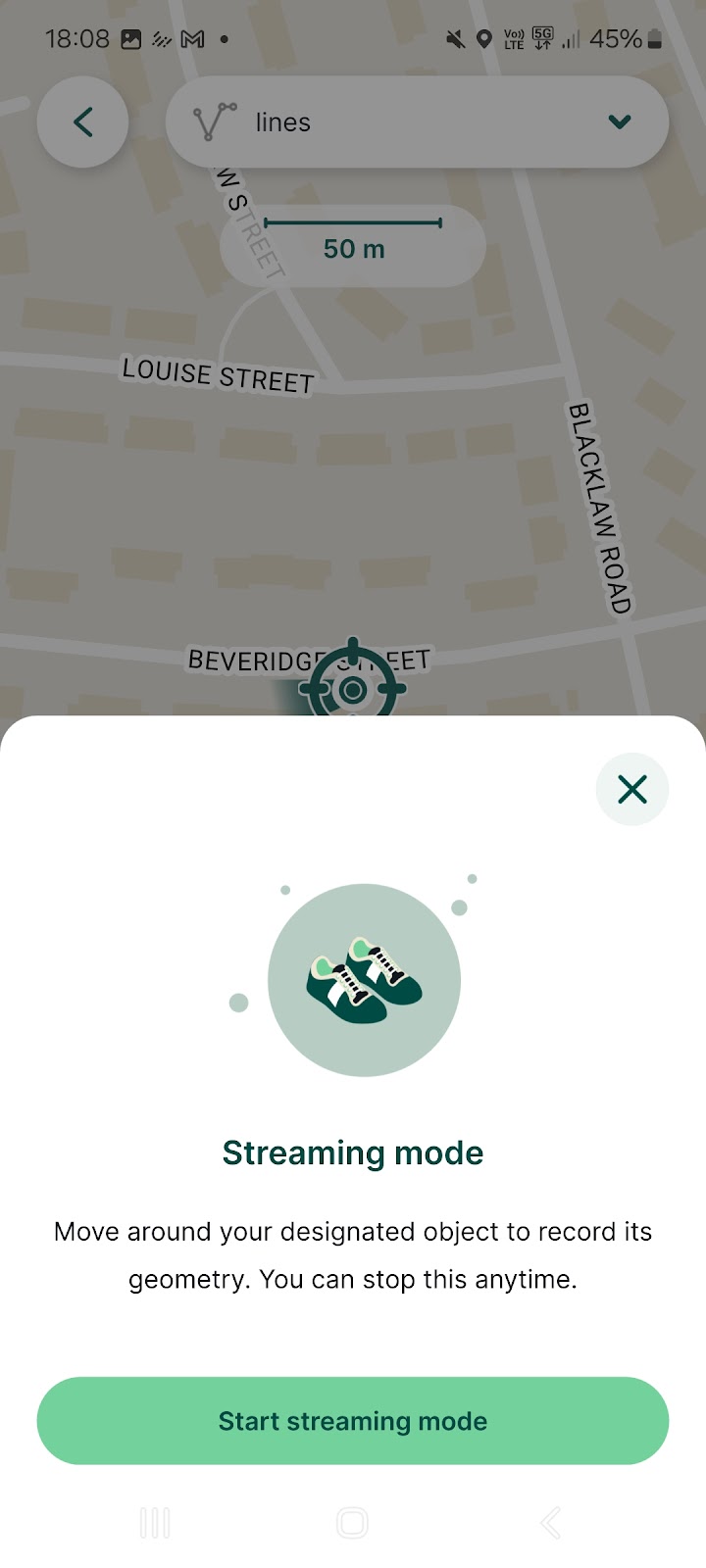
3. Next, the app will ask you to confirm that you wish to begin recording, click “Start streaming mode” to begin:
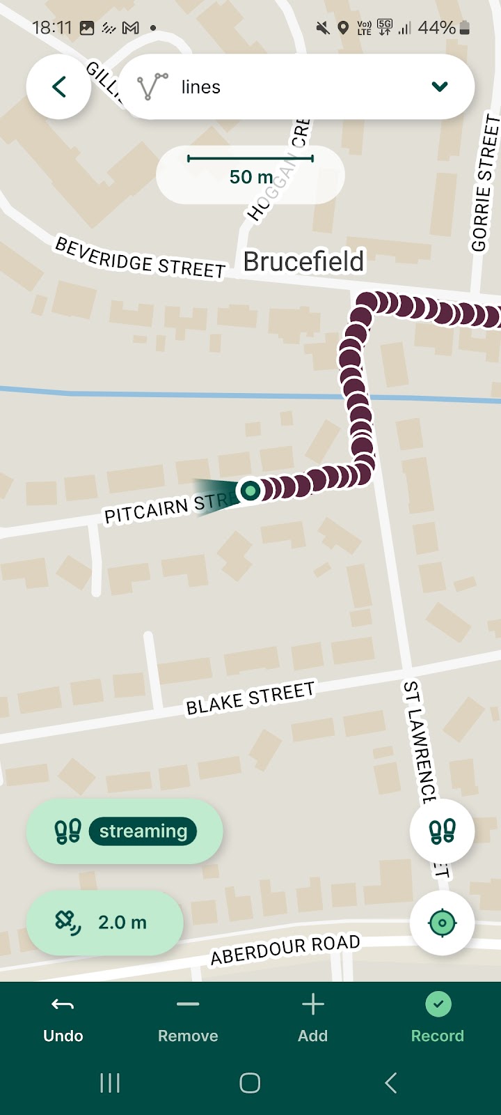
4. Now the app will automatically record points at intervals based on the settings you chose earlier. While you are recording, make sure the app remains active and your screen remains on until you finish. Once you have recorded everything, click the green button on the left of the screen that says “Streaming”:
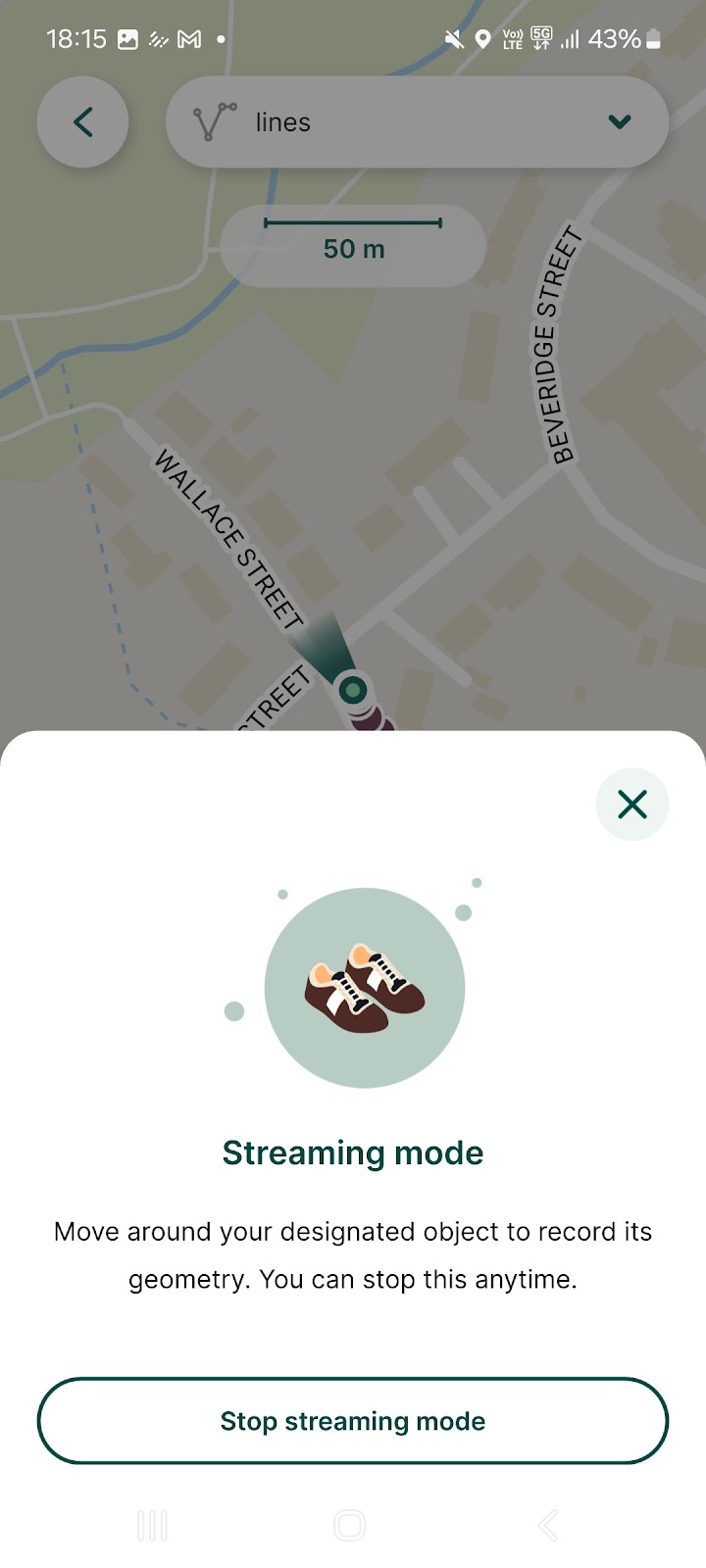
5. Now the app will ask you to confirm that you wish to end the recording, click the “Stop streaming mode” to finish:
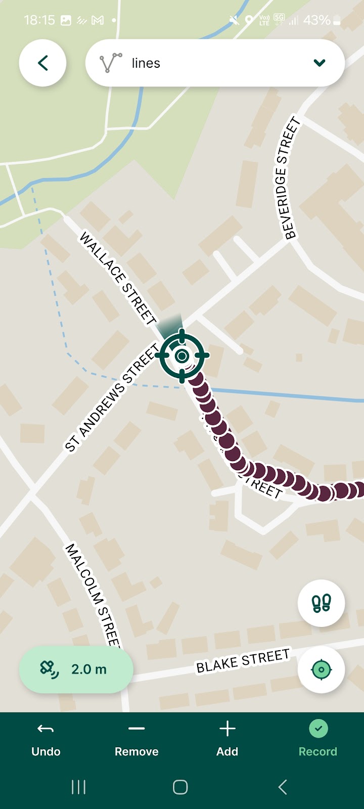
6. The app will exit the streaming mode, now you need to click the green “Record” button at the bottom right of the screen to save the recording. Just like with the manual method, the app will close the shape if you are recording a polygon:
7. The app will then return to the form for the feature you just created. Enter any information in the fields that you need and then make sure to click the green check button at the top right of the screen to save your recording:
Things to consider for your project
Next we will compare some of the strengths and weaknesses of each method. When deciding how to record lines and polygons in the Mergin Maps mobile app, you will need to consider several factors such as weather conditions, battery usage, the terrain you will be walking on, if you need to turn your screen off or switch between other apps.
Streaming
Pros
- You can get a more accurate recording of boundaries or paths
- Recording of points is done automatically at intervals you can set based on distance or time
- Less opportunity for human error as the app automatically collects the points
Cons
- The app must be open at the forefront and you cannot lock the device screen during recording
- Higher battery use
- May be inconvenient to use if you are traversing difficult terrain or travelling long distances
Manual
Pros
- You can decide which points to record, depending on how detailed you need the recording to be
- As long as you do not close the app, you can have it in the background or lock your device screen between point recordings
- You will use less battery with this method
- May be a better option in bad weather or difficult terrain where you need to put the device in your pocket or turn off the screen to avoid water drops on the screen
Cons
- Points may be recorded at irregular intervals
- You have to remember to record each point or you may have to redo the recording or edit it later
- Greater possibility of human error
Weighing the options
Both the manual and streaming methods are excellent ways to record lines or polygons. You will need to consider which method will be the best for your project and working conditions. For example, if it is raining you might wish to use the manual method so you can switch the screen off on your device and carry it in your pocket to keep it out of the rain. On the other hand, you may need to ensure a higher resolution of points which can be achieved with the streaming mode. Regardless of which method you choose, it is easy to edit the geometry of features that have been recorded if you need to go back and make changes.