GPS Accuracy
Your GPS accuracy depends on several parameters, such as:
- Your GPS device. External GPS may be used to achieve higher accuracy.
- View of the clear sky that affects the number of satellites visible from your position
When doing the survey, it is essential to be aware of the limitations of your GPS accuracy at the time of recording.
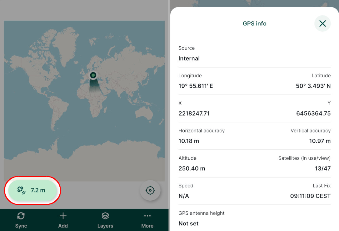
Current GPS accuracy is displayed above the bottom navigation panel in the mobile app. Also, there is a circle with the estimated size of the accuracy value around the position marker.
The colour of the GPS button denotes the accuracy threshold that can be set in the GPS settings in the mobile app. By default, it is set to 10 m. The indicator is green when the accuracy threshold is met, otherwise it turns yellow.
Tapping the GPS button opens the GPS info panel, which contains information about the horizontal and vertical accuracy, as well as number of satellites in use. 
If you'd like to have higher accuracy, you can wait for your device to acquire a better GPS signal. For precise measurements, you may need to connect your device to an external GPS.
When assessing the overall quality of the survey, it may be beneficial to record some extra position variables, such as type and name of the used GPS device, the horizontal and vertical accuracy or the horizontal, vertical or position dilution of precision (HDOP, VDOP, PDOP).
TIP
GPS accuracy can be one of the reasons for misplaced or shifted field data. Visit our blog Why are my survey points shifted? to read more about this topic.