# How to Stake Out Points
Points in your survey layers can be staked out. The mobile app will navigate you towards the selected point showing you the direction and distance.
There are two stake out modes long navigation mode and short navigation mode that is activated when you are less than 1 m away from the point.
TIP
Accurate stake out in short navigation mode may require an external GPS receiver with GPS corrections.
# Stake out in Mergin Maps mobile app
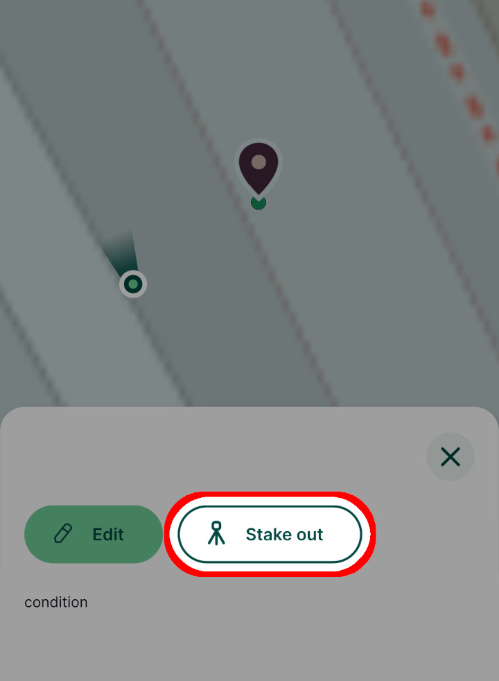
Select a point in your map window. From the form tap the Stake out option:

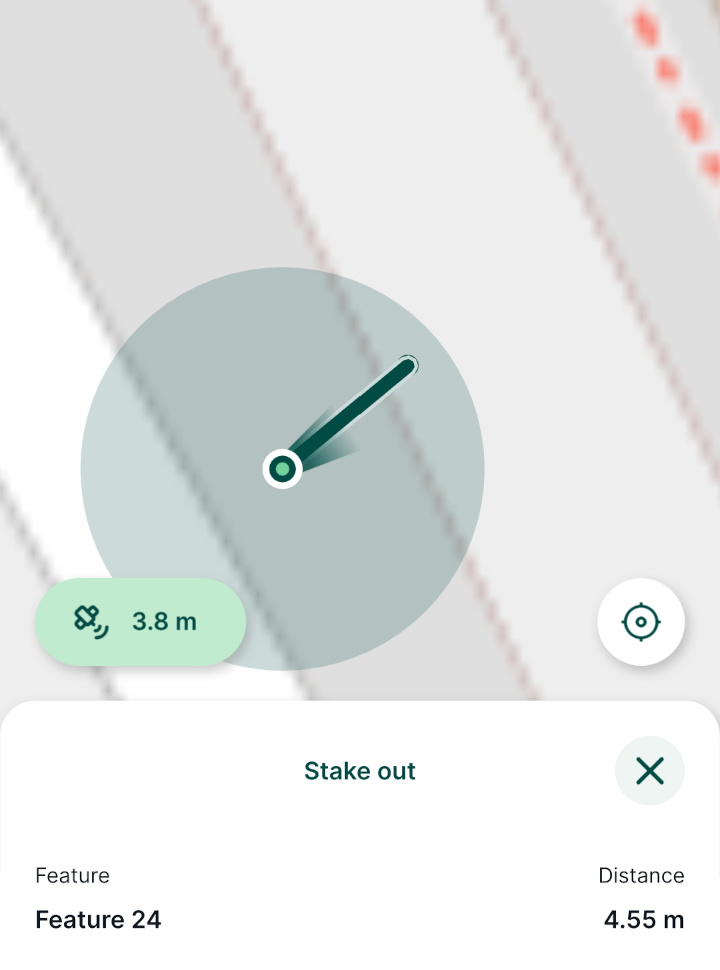
Stake out panel will display the current distance and a connecting line between your position and the point.

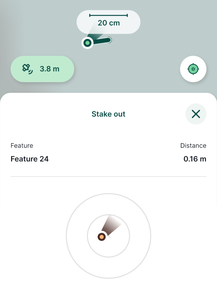
Once you are closer to the point (less than 1 m), the stake out panel will switch to the short navigation mode.

Precise stake out of the point (distance less than 10 cm) will be highlighted by green.
# Changing stake out distance units in QGIS
Distance units displayed by the mobile app are defined in your project properties:
Open your Mergin Maps project in QGIS
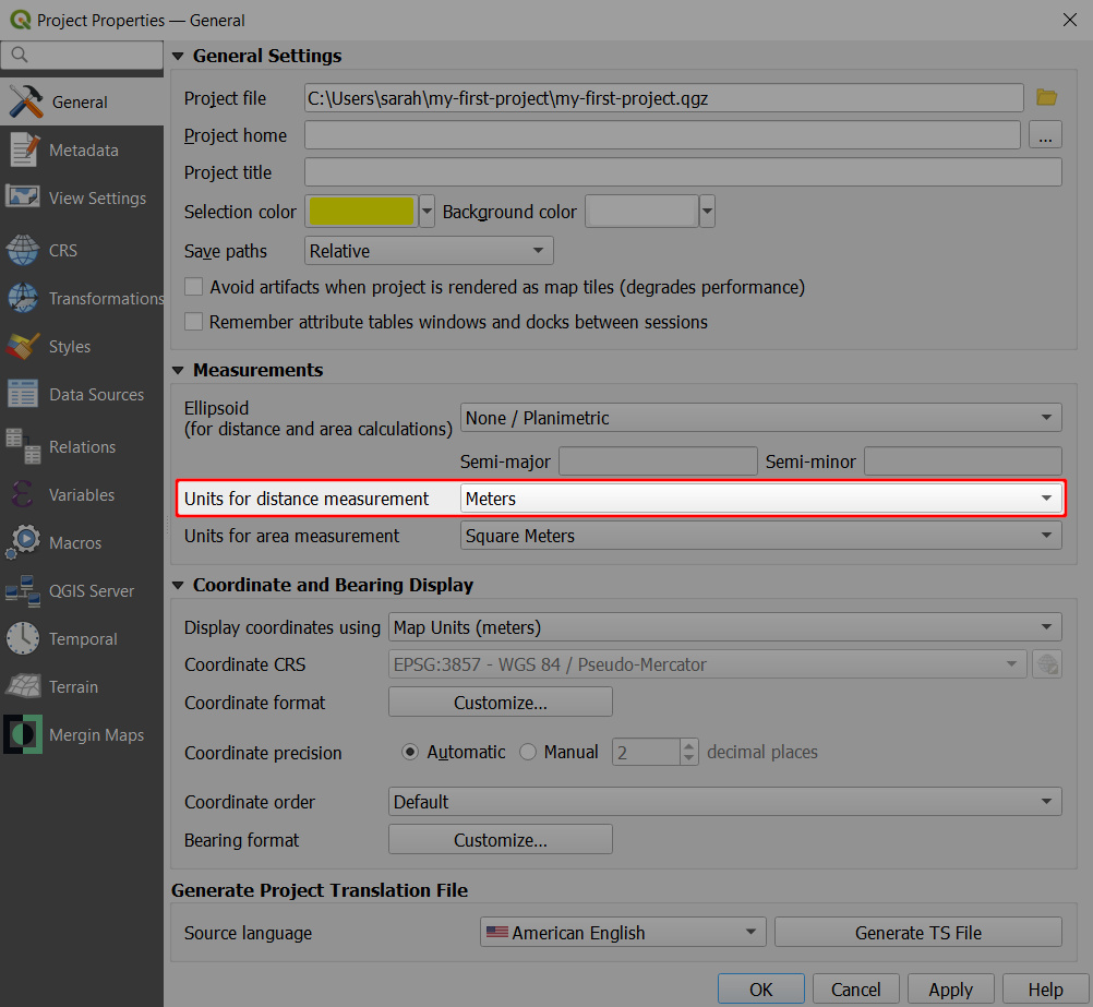
Navigate to Project Properties
In the General tab, you can define the Units for distance measurement by choosing from several options, such as metres, miles, yards or feet.
Units defined here are then used by default when measuring distances in QGIS, as well as during stake out in the mobile app

