


Locals struggle to keep up with pace of urbanisation
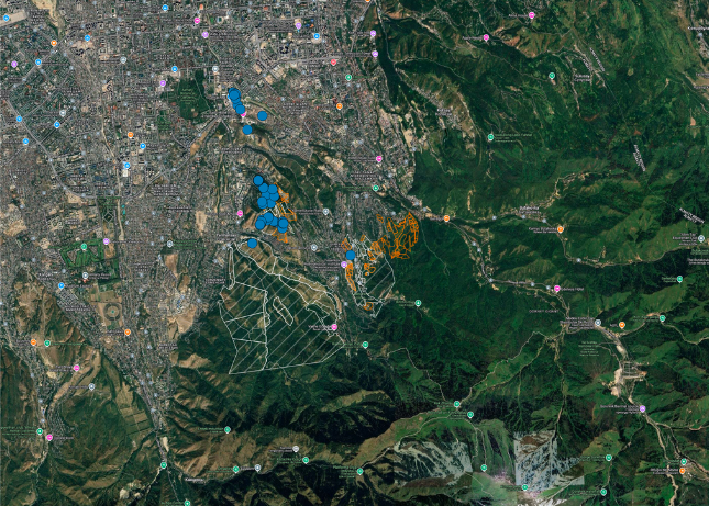
The Almaty region of Kazakhstan is famous for its historic apple orchards. The orchards in this region date back to some of the first human cultivated apple orchards in history, some of the world’s oldest wild orchards also exist in this region. Therefore, the conservation of apple orchards and forests in Almaty is of utmost importance for global food security.
However, these orchards and forests are under threat from rapid urbanisation in the region. Although there are national laws to protect these vital natural resources, they are not always well enforced and local property developers and officials are known to take advantage of poor enforcement practices to cut corners and speed up construction of new developments.
Unfortunately, there is not enough legal expertise in the region for locals to stand up and protect the resources important to their communities. Lawyers can end up spending days working on a single complaint while illegal construction continues.
Using Mergin Maps to report suspected violations
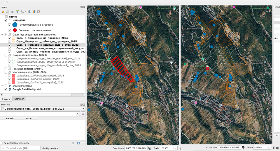
Activists have created Almaty orchards Landscape Memorial Alliance (ALMA) to help local communities protect the vital landscape of Almaty. Using Mergin Maps, ALMA has created an app that will let users record suspected violations of natural protection laws by recording the location and photos of any suspicious developments.
To report a suspected violation, the user just needs to take a photo and provide a brief description to the Mergin Maps app and then synchronise the data to the project. The data collected in the Mergin Maps project is then analysed by a custom deployment of Gemini 2.0 that has been trained specifically on regulations and legal documents relevant to the preservation of natural resources.
If a violation is suspected to be likely, then the AI agent will compile the relevant forms and information the user will need to fill out themselves and submit to the local authorities to report the suspected violation and send it to the user.
A much improved process for reporting
The straightforward interface of Mergin Maps makes it easy for volunteers to record data quickly and efficiently. The app also works well offline, which is important since data connectivity can be poor in the mountainous regions. The simple interface means that users can quickly record evidence without raising suspicions. This is important because activists often face threat of reprisal for reporting these types of violations.
The workflow with Mergin Maps and Gemini has also significantly reduced the time needed to report issues to local authorities. Before using Mergin Maps, it would take up to three days to collect information and prepare a legal complaint about a suspected violation. Now the reporting system with Mergin Maps and Gemini will submit the information to the user within 30 minutes of them sending evidence to the project.
As one activist put it, “Now we are able to move quickly, like special forces, to report violations”. The organisers of ALMA are pleased with the results of using Mergin Maps with Gemini to report violations of natural protection laws and projects like this could be a good template for activists around the world to use for community empowerment.


