


Mergin Maps used for efficient mapping and recording of weed clearance in environmentally important wetland of Swan Bay.
Mergin Maps can in theory handle everything you’d ever want for a mapping tool! Dr Greg Parry BSc (Hons), PhD - 8 December 2021
Greg Parry is President of the Swan Bay Environment Association in the Borough of Queenscliff, Victoria, Australia. This semi-retired marine ecologist runs a one-man ecological consulting business, Marine Ecological Solutions.
Importance of Swan Bay
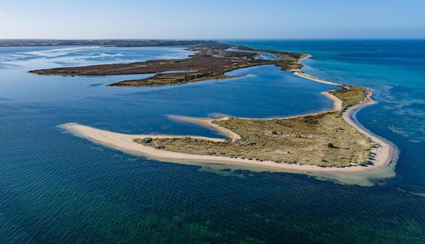
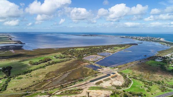
Swan Bay is a significant marine wetland with an area of 30 km2, situated near the entrance to Port Phillip Bay on the south-central coast of the Province of Victoria. This is an important bird habitat, supporting the life of about 200 different bird species. It has been recognised as an area of international importance under the Ramsar Convention. Every October, Swan Bay is visited by thousands of migratory shorebirds. More than 3 000 Black Swans can be seen in the bay in Summer and Autumn. The seagrass in Swan Bay is also an important habitat for a variety of fish and other marine life.
Aims of the Swan Bay Environment Association
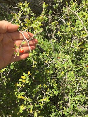
The natural flora and fauna in the area are under threat by environmental weeds. Among the 300 different plant species, about 50 % are alien. Invasive environmental weeds harm native plants and animals, the natural landscape and threaten the biodiversity of indigenous species. The three main invasive weeds in Swan Bay are Italian Buckthorn, African Boxthorn and Polygala myrtifolia (myrtle-leaf milkwort from South Africa).
A team of volunteers from among the 120 members of the Environment Association will assist with the removal of invasive weeds. Some of these are so large or spiny they need to be cleared by contractors. Others require spraying, while many will be cleared manually by a team of volunteers.


Need for Effective Mapping
This is where Dr Parry’s expertise comes in – together with Mergin Maps. He realises the urgent need for effective mapping and planning, to co-ordinate the work of volunteers. If this is not done, there is “inadequate follow-up, so it is a waste of their time and energy”. He emphasises, “We need better records of when places are weeded and how they are weeded.”
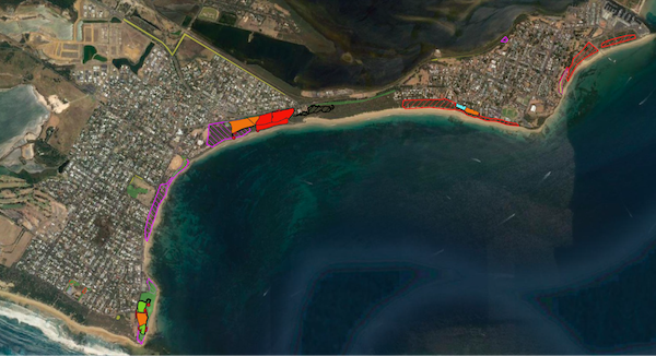
The role of accurate mapping is two-fold: firstly to create a historical record of past weeding and to assess weed density, and, secondly, to identify the areas for future weeding.
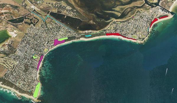
Dr Parry has classified the following categories for weeding as:
- areas suitable only for contractors requiring heavy equipment, (RED on map)
- areas suitable for contractors or volunteers – more open areas, usually where the worst weeds have already been removed by contractors, (ORANGE on map)
- areas suitable for volunteers – few weeds requiring diligent searching, and many man-hours but limited manual labour, (GREEN on map)
- areas where drainage has increased weed infestations so that drainage should be tackled before weed removal makes sense. (BLUE on map)
-
Dr Parry realises the need to store the information accurately (how much work has been done, the man-hours and number of people, etc.) and then to analyse it, so as to achieve a more effective job by volunteers in future.
Conclusion
Dr Parry finds that Mergin Maps app has all the features required for this project. It will be very useful for volunteers in the field, especially as it is usable by both iOS and Android. He thinks it is “remarkably cheap”, compared to the software he had previously been using.
He has some experience with GIS and, after watching a YouTube instructional video, has managed to incorporate QGIS and set it up without many problems. Once he has fine-tuned the set-up, he is sure that he will be able to enlist many more willing volunteers for this important undertaking.
Back in 2005, Dr Parry had used a Magellan Mobile Mapper hand-held device for mapping, which was bulky and cost about $7 500. “Now all of the capacity of that system is available on your phone!” He is motivated to incorporate the user-friendly features of the app in order to achieve his main long-term objective:
This information, I think, will be very helpful in improving co-ordination of weeding efforts within the borough and ensuring that resources are used efficiently. Over a few years, we will get a much better concept of the resources required to do the job in total. I’d summarise it to say we should be a bit more strategic about it, so as to be more effective.


