


We spoke with Anna Cluley from the Derbyshire Historic Buildings Trust (DHBT) about how they are using Mergin Maps to monitor historic buildings. Anna is the Heritage Development Officer and is working on a ‘Buildings at Risk’ (B@R) project. The DHBT is a UK-registered charity and was founded in 1974 to preserve historic buildings that are listed or considered of local importance, prevent them from falling into disrepair and enable them to be reused sustainably.
The B@R project is focused on engaging volunteers to collect data on the condition of important Grade 2 (G2) listed buildings. There are currently around 130 volunteers engaged in the B@R project with DHBT.
Training volunteers helped by simplified user interface
Historic England is responsible for monitoring Grade 1 buildings and certain G2 buildings, but local authorities are responsible for the majority of G2 buildings. The DHBT have had assistance from the West Midlands Historic Buildings Trust (now the West Midlands Heritage Trust), who created the B@R project in Mergin Maps with support from Historic England.
The biggest challenge for the survey is that there are thousands of buildings that need to be inspected, with limited resources. In some cases, the existing data held by the councils is out of date. The project has an initial scope of funding for a two-year period to complete the survey in certain local authority areas, so DHBT are enlisting the help of local organisations and groups of volunteers to carry out the surveys.
Due to the reliance on volunteers, the technical solution for the survey needed to be accessible to people of various levels of experience. They also have limited time to train individuals meaning that onboarding needed to be relatively straightforward. They offer training sessions and open drop-in sessions where volunteers can come and learn how to use the app and do the surveys. However, in some cases the training needs to be self-led by the group of volunteers. Many of the users have been surprised with how easy it is to collect the data in the Mergin Maps app.
Gathering the data
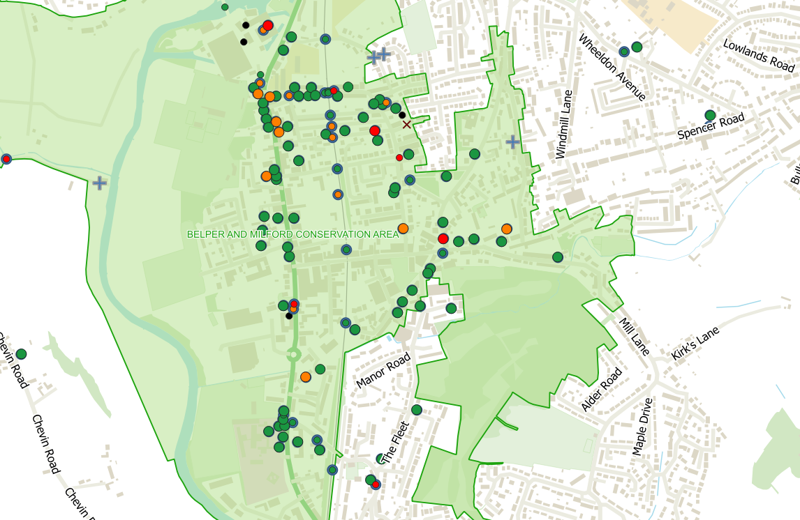
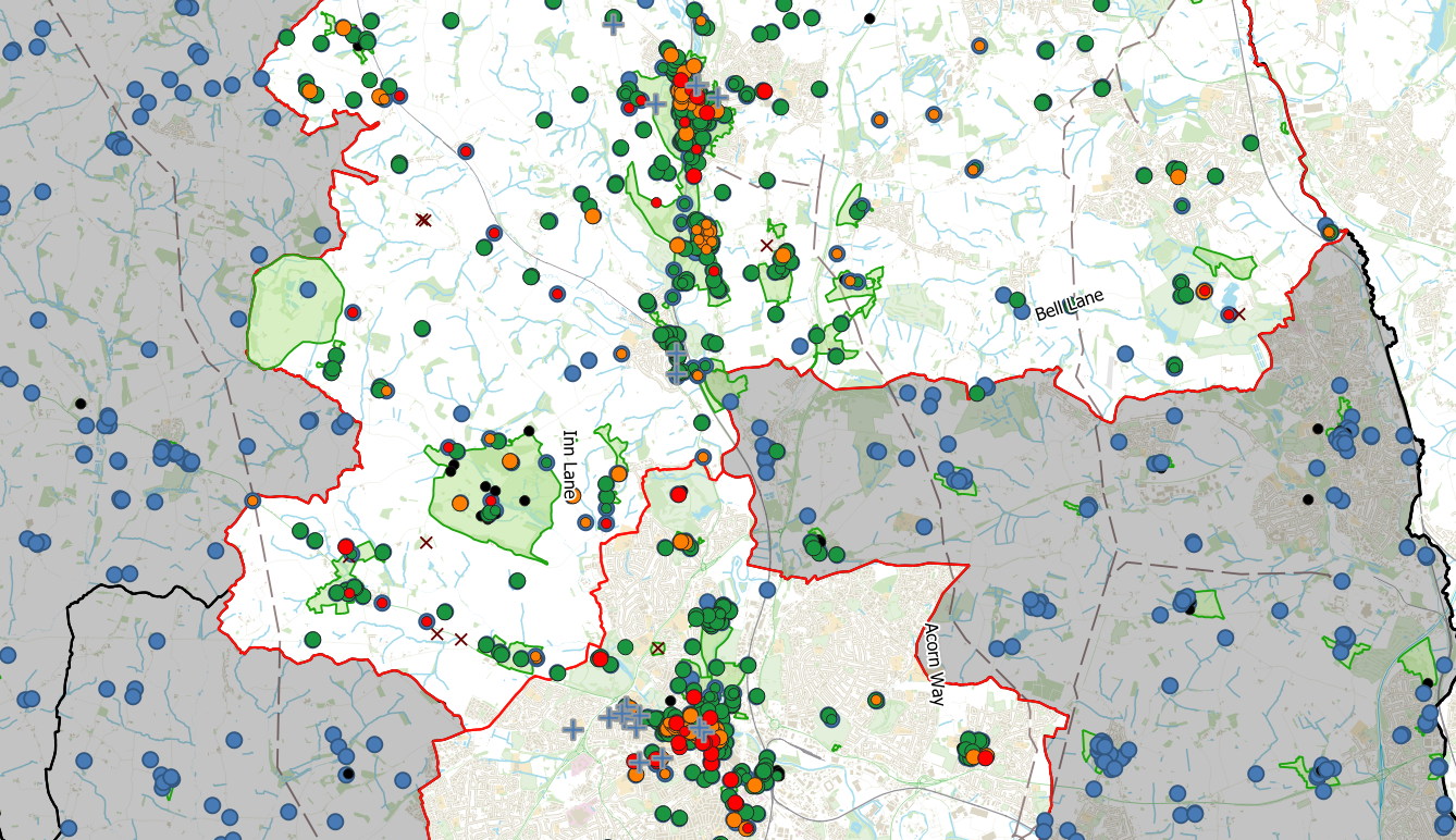
The volunteers need to collect various information about the buildings in the survey. The volunteers collect data about different parts of each building to be surveyed such as the roof, gutters, wall structure and other areas and a risk category is generated based on the inputs as well as the occupancy status of the building. The risk categories are then colour-coded on the map so they can be identified. If a building is determined to be at risk, they can develop an action plan to improve the condition. A local ‘At risk’ register is created and the local authority can follow up with owners as needed.
Volunteers can also add buildings that they think should be listed but are not included in the survey. The building can then be evaluated later on to determine if it should be assessed for a graded listing.
Preparing for the future
So far, DHBT have been able to complete surveys on around 1100 buildings across their initial target area. Amber Valley and Derby are mostly completed, and they are beginning assessments of properties in the South Derbyshire district this August. The project is funded for two years and after the initial funding phase is completed, they hope to continue the project beyond the initial phase and survey the Grade 2 listed buildings across the rest of the county.
To find out more about DHBT’s innovative use of Mergin Maps for the B@R project, you can visit the relevant pages on their website here.
This project has been made possible thanks to The National Lottery Heritage Fund thanks to National Lottery players.


