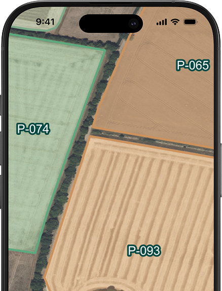
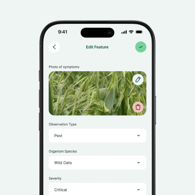
Optimise agricultural mapping, streamline crop tracking, and conduct precise soil sampling with ease. Digital field surveys empower agronomists and farm consultants to collect geolocated data, monitor pest outbreaks, and record irrigation details directly from the field—even in remote areas without a network connection.
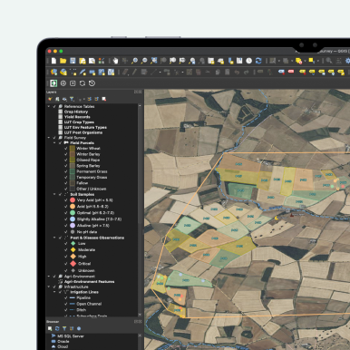
Data synchronises instantly with office teams via Mergin Maps, enabling faster decision-making for agri-environment compliance and more efficient harvest planning. Whether you are benchmarking yields or mapping farm assets for subsidy submissions, these digital workflows eliminate manual transcription, reduce paperwork, and improve data accuracy across the entire crop rotation cycle.

Lorem ipsum dolor sit amet, consectetur adipiscing elit, sed do eiusmod tempor incididunt ut labore et dolore magna aliqua. Ut enim ad minim veniam, quis nostrud exercitation ullamco laboris nisi ut aliquip ex ea commodo consequat.


.webp)